Black Canyon of the Gunnison is not a casual day trip—it's a deliberate pilgrimage to one of the most vertigo-inducing landscapes in the American West. The Gunnison River has spent 2 million years carving a gorge so narrow that parts receive only 33 minutes of sunlight per day. For reunion groups, this park delivers something rare: a shared experience of genuine awe that strips away phone distractions and forces everyone into the present moment. The logistics require planning—this is remote, high-altitude wilderness with no services inside the park—but the payoff is a bonding experience your family will reference for decades.
Planning a broader Colorado reunion? Read the Colorado State Planning Guide.
South Rim Drive
The 7-mile South Rim Drive is the park's main artery and the most accessible way to experience the canyon's scale. Twelve designated overlooks line the route, each offering a distinct perspective on the 2,000-foot vertical drop. The road is paved, well-maintained, and navigable by standard vehicles including passenger vans. For reunion groups, this drive functions as a self-paced tour where everyone can stop at their comfort level—some overlooks require only a 50-foot walk from the parking area, while others connect to short rim trails.
SCOUT LOGISTICS
Parking reality: Overlook parking lots hold 8-15 vehicles each. During July-August peak hours (10 AM–2 PM), the most popular stops—Gunnison Point, Chasm View, Painted Wall—fill completely. Arrive before 9:00 AM or after 3:00 PM for guaranteed parking. For groups with 3+ vehicles, designate a caravan order and a "skip and circle back" strategy for full lots. The full drive takes 45 minutes without stops, but budget 2.5-3 hours to properly experience 6-8 overlooks with group photo time. No guardrails at most overlooks—keep children within arm's reach at all times.
Website: nps.gov/blca
Painted Wall Overlook
The Painted Wall is Colorado's tallest cliff face at 2,250 feet—higher than the Empire State Building stacked on itself. Light-colored pegmatite dikes streak across the dark Precambrian gneiss and schist, creating natural "paintings" that shift in appearance with the sun's angle throughout the day. The overlook provides the park's single most photographed view and the moment where most visitors truly grasp the canyon's impossible scale. For reunion groups, this is your mandatory group photo location.
SCOUT LOGISTICS
The overlook parking lot holds approximately 12 vehicles. A short paved path (under 100 yards) leads to the viewing area—fully accessible for wheelchairs and strollers. Best light for photography: Morning sun illuminates the pegmatite veins most dramatically between 8:00-10:00 AM. By afternoon, the wall falls into shadow. The viewing area is exposed with no shade—bring sun protection during summer months. Wind can be fierce at the rim; secure hats and loose items. Cell service is nonexistent here, so establish your group's next meeting point before splitting up.
Website: nps.gov/blca
Warner Point Nature Trail
The Warner Point Nature Trail is a 1.5-mile round-trip moderate hike that terminates at the highest overlook on the South Rim, delivering panoramic views of the canyon, the San Juan Mountains, and the Uncompahgre Valley. The trail winds through Gambel oak and serviceberry with interpretive signs explaining the park's ecology. At the endpoint, you stand 2,722 feet above the river—the deepest point visible from any maintained trail in the park. This is the hike for reunion members who want to earn their view.
SCOUT LOGISTICS
Fitness requirement: Moderate difficulty with 260 feet of elevation change. The trail sits at 8,300 feet elevation—guests unacclimatized to altitude will feel winded faster than expected. Budget 1-1.5 hours for the round trip with a group. The trailhead is at the end of South Rim Drive (High Point parking area, ~8 spaces). No water available on trail or at trailhead. Each person needs minimum 32 oz of water for this hike. The trail is not wheelchair accessible. Afternoon thunderstorms are common June-August; start before 11:00 AM to avoid exposed ridgeline during lightning. Regroup at the parking lot—the endpoint has no cell service for coordination.
Website: nps.gov/blca
East Portal Road
East Portal Road is the only vehicle-accessible route to the bottom of Black Canyon, descending 2,000 feet in just 5 miles via a 16% grade—one of the steepest paved roads in Colorado. At the bottom, you reach the Gunnison River at the Crystal Dam, where Gold Medal trout fishing waters and a picnic area await. The descent transforms the canyon experience from "looking down" to "looking up," and the temperature drops noticeably as canyon walls block direct sunlight. For reunion groups with anglers or anyone wanting river-level perspective, this is essential.
SCOUT LOGISTICS
Vehicle restrictions: No vehicles over 22 feet in length. The road's 16% grade with sharp switchbacks prohibits RVs, trailers, and large passenger buses. Standard SUVs and minivans handle it fine, but use low gear on descent and ascent. The road closes seasonally (typically November through mid-April depending on snow). At the bottom, parking holds approximately 20 vehicles. A valid Colorado fishing license is required for anyone casting a line—purchase in Montrose before entering the park. The picnic area has vault toilets but no running water. Allow 30-40 minutes each way for the drive, plus activity time at the bottom. This is a half-day commitment minimum.
Website: nps.gov/blca
Gunnison Point Visitor Center
The South Rim Visitor Center at Gunnison Point is your group's orientation hub and the first overlook you encounter after entering the park. Inside, ranger-led exhibits explain the canyon's geology, wildlife, and human history. The adjacent Gunnison Point overlook delivers an immediate, visceral introduction to the canyon's depth—2,000 feet straight down to the river. Ranger programs run daily in summer, including geology talks, junior ranger activities for kids, and evening astronomy programs that leverage the park's International Dark Sky designation.
SCOUT LOGISTICS
Start here. The visitor center parking lot is the largest in the park (~30 spaces) and your best bet for regrouping a multi-vehicle caravan. Restrooms with running water are available here—the only flush toilets on the South Rim. Ranger programs are free with park admission ($30/vehicle, valid 7 days). Junior Ranger booklets are available for kids ages 4-12 and take 1-2 hours to complete while exploring the rim. Evening astronomy programs (summer Fridays/Saturdays, 8:30 PM) require no reservation but bring warm layers—rim temperatures drop into the 40s after sunset even in July. The bookstore stocks trail maps, field guides, and the only bottled water available inside the park.
Website: nps.gov/blca
North Rim
The North Rim offers a completely different character than the developed South Rim—wilder, quieter, and accessed via an unpaved road that filters out casual visitors. Six overlooks along the North Rim Road provide perspectives you cannot get from the south side, including views directly across to the Painted Wall. The Chasm View Nature Trail (0.3 miles) on the North Rim delivers the park's most vertigo-inducing viewpoint, where you peer straight down into the canyon's narrowest section. For reunion groups seeking solitude and a sense of genuine wilderness, the North Rim delivers.
SCOUT LOGISTICS
Access warning: The North Rim Road is unpaved gravel for the final 7 miles. High-clearance vehicles are recommended; low-clearance sedans risk undercarriage damage on washboard sections. The road is impassable when wet. The North Rim closes entirely from mid-November through mid-April. There is no visitor center, no running water, and no ranger station on the North Rim—only vault toilets at the campground. Cell service is completely nonexistent. The drive from Montrose to the North Rim takes approximately 1.5 hours (vs. 25 minutes to the South Rim). For groups, this is a committed full-day adventure best suited for members comfortable with remote conditions. Designate a firm departure time and meeting point before entering—you cannot text updates once inside.
Website: nps.gov/blca
Frequently Asked Questions
Is Black Canyon of the Gunnison accessible for family members with mobility limitations?
The South Rim Drive overlooks are paved and wheelchair-accessible, including Gunnison Point, Pulpit Rock, and Painted Wall. However, all inner canyon routes require steep, unmaintained trails with significant elevation loss. Groups with mobility-limited members should plan activities around the rim overlooks and visitor center, which provide dramatic views without strenuous hiking.
What is the best time of year to visit Black Canyon of the Gunnison with a large group?
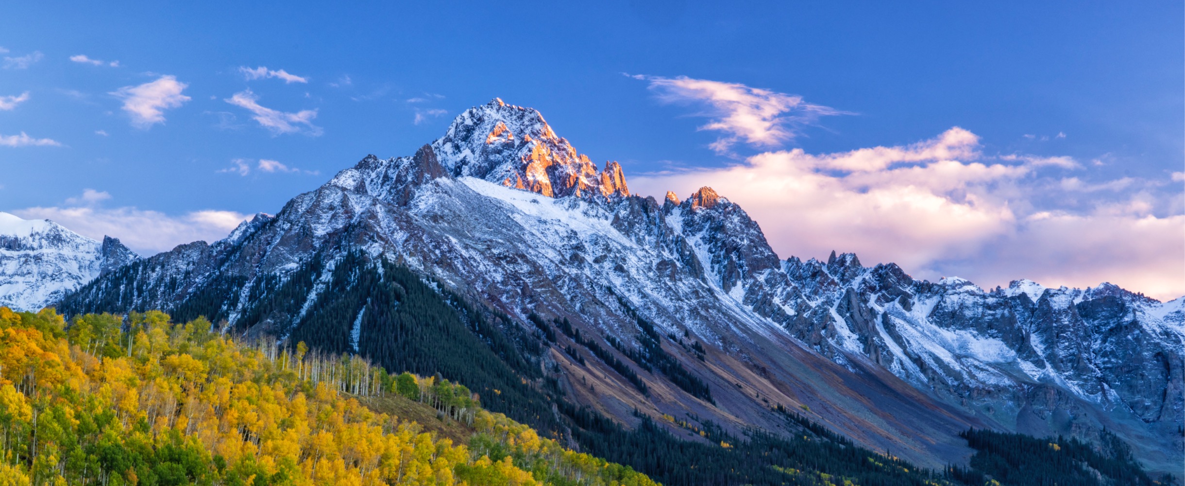
Late May through early October offers the best conditions. The South Rim Road is fully open, all overlooks are accessible, and ranger programs run daily. June through August brings the warmest weather but also peak visitation. September offers fewer crowds, golden aspens on the drive in, and comfortable hiking temperatures in the 60s-70s. Winter closes the North Rim entirely and limits South Rim access.
How remote is Black Canyon of the Gunnison and what should groups plan for?
The park is genuinely remote. The nearest full-service town is Montrose, 15 miles from the South Rim entrance. There are no restaurants, gas stations, or lodging inside the park—only a campground. Cell service is unreliable throughout. Groups should fuel up in Montrose, pack lunches and extra water, designate a meeting point in case members separate, and plan for a full day commitment once inside the park.
Ken O.
Founder of AmazingReunion and veteran reunion organizer who has coordinated 50+ family gatherings across the US.